 Sheila Sweetinburgh
 2239
2239
At a time when everyone is busy, I’ll make this a short report and solely tell you about Dr Neil Murphy’s research seminar talk last Thursday to a packed room at Canterbury Christ Church. I have heard Neil discuss royal progresses before, but this time he turned his attention to cartography.
Consequently, his audience of history staff, postgraduates and members of the public heard him give a fascinating assessment of how and why Henry VIII was keen to commission a series of maps and plans covering the area of the Boulonnais. For having captured Boulogne in 1544, the king was intent on establishing an English colony in this area of France that extended his rule beyond the Calais Pale. Not that this was Henry’s first foray into map making. During the previous decade coastal maps had been produced to highlight the new fortifications, such as Deal Castle, and even earlier in his reign the need to have coastal maps to aid mercantile shipping had been acknowledged, which included the coastal strip covering Faversham Creek as part of the Medway and Thames estuaries. Furthermore, as Neil mentioned, mapping would remain important, firstly for the Elizabethan colonization of Ulster, and thereafter for Virginia and other parts of the New World. Nor were all these maps what we would call maps today, because picture maps were to be used for display in royal and municipal buildings, thereby recalling specific incidents as a means to celebrate and commemorate English domination.
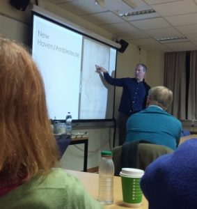
Neil discusses the ‘new’ settlement of New Haven (Photo: Dr Diane Heath)
Neil showed his audience a number of these maps produced by Sir John Rogers and Sir Richard Lee, these being the first to employ scale, and included the positioning of hills, woodland, rivers, and churches. They also differentiated between newly resettled and depopulated settlements – buildings without roofs, the previous inhabitants having been cleared by the English troops, becoming refugees in the wooded areas. Thus, the English could use these maps to navigate their way around this new territory, but Henry was keen to see and comment on them too, for they showed him how the conquest and colonization were progressing. Indeed, Neil said Henry back in England was heavily involved, adding copious notes and comments to these maps and plans that were then relayed back to France. Presumably for the engineers involved, this opportunity to advance their surveying skills and techniques was greatly appreciated, although perhaps the king’s interventions less so.
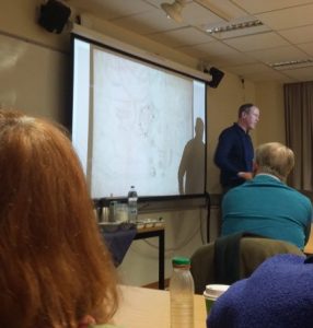
Neil points out the value of new surveying techniques (Photo: Dr Diane Heath)
The new settlers were drawn primarily from Kent, although the mechanisms whereby this was undertaken are much more difficult to ascertain, nor do we know who they were. Neil believes this policy was adopted because it was thought farming conditions would be very similar, and some in Kent already had connections to the Calais Pale. Nor was it solely a movement of people because the new area was put under the English common law, the settlement names were changed and the churches were under the Protestant regime, all of which was defended by garrisons stationed in the various towns.

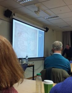
Neil explains how fronteirs were demarcated (Photo: Dr Diane Heath)
Interestingly, Neil showed the map that marked the frontier between this English territory and France. This demarcation was based on the river and denoted by a dotted line, which was a new concept at the time. In addition, such maps showed the high-water mark of the river, as well as the sites of mills, all of which were viewed as valuable indicators of industry and commerce by the English surveyors and the king.
Neil concluded by reiterating how these developments in surveying and understanding what maps could and could not do would be further refined in Elizabeth’s reign and beyond. It was obvious from the applause how much his audience had enjoyed the lecture, and Neil then answered a considerable number of questions from all three sections of the audience.
Neil answered a broad range of questions (Photo: Dr Diane Heath)
Professor Louise Wilkinson, who had chaired the seminar, thanked Neil again for his fascinating talk and then announced that there will be further research seminars next term, the first being given by Abby Armstrong, who has recently successfully passed her PhD viva. Abby will give her paper on the daughters of Henry III. All welcome, and you are also welcome to the first joint lecture organised by the Centre and the Friends of Canterbury Archaeological Trust on Thursday 31 January when Dr Steve Willis (University of Kent) will be speaking on ‘Roman Lympne: context, new research and new questions’.


