 Jason Shirley
 10992
10992
Climate Change Curriculum Pack
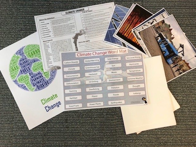
A collection of resources designed to assist with both teaching and learning covering many aspects of the climate. This pack is designed to be used with both key stage one and two children exploring climate change, what causes it and what we can do to help prevent it.
The pack includes: one climate poster, one global warming poster, one word cloud, one word mat, one quiz pad and six photocards.
Find this resource: CR 551.6 CLI (EQ)
Weather Curriculum Pack
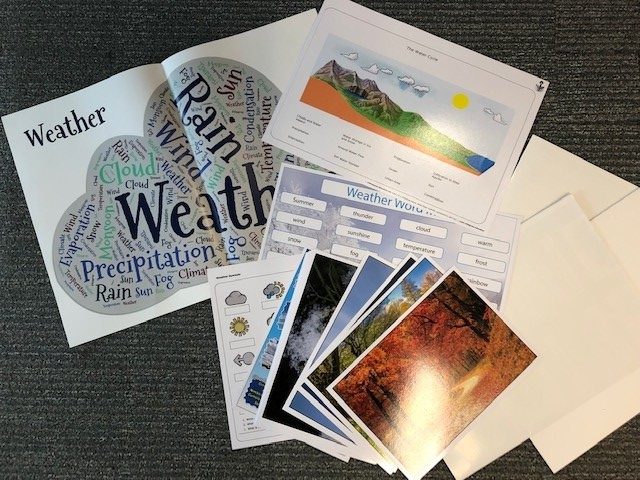
A collection of resources designed to assist with both teaching and learning covering many aspects of weather, including seasons, symbols, water cycle and cloud formations. This pack is designed to be used with both key stage one and two children, helping to develop observational and recording skills.
The pack includes: one weather symbols poster, one cloud poster, one word cloud, one weather chart, one word mat, one activity leaflet, eight weather photocards and 4 seasons photocards.
Find this resource: CR 550 WEA (EQ)
Coasts Curriculum Pack
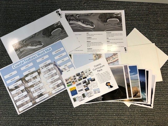
A collection of resources designed to assist with both teaching and learning covering many aspects of geographical coast. This pack is designed to be used with both key stage one and two children providing geographical knowledge and vocabulary.
The pack includes: one poster, one word cloud, one word mat, two activity mats, keywords leaflet, eight features postcards and four formation photocards.
The National Geographic is a great resource for all this natural world. Check out the coastal article and maybe follow several of the links for additional coastal information.
Find this resource: CR 910.02 COA (EQ)
The Americas Curriculum Pack
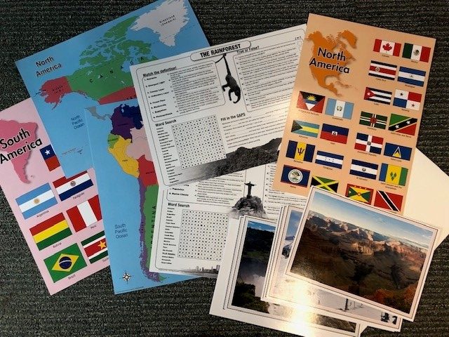
A collection of resources designed to assist with both teaching and learning covering many aspects of the Americas. This pack is designed to be used with both key stage one and two children.
The pack includes: one map of the entire Americas, one map of North America, one map of South America, two flag posters, three quiz cards, six photocards and two activity sheets.
Find this resource: CR 917 AME (EQ)
World and British Isles White Board Set
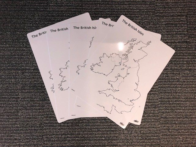
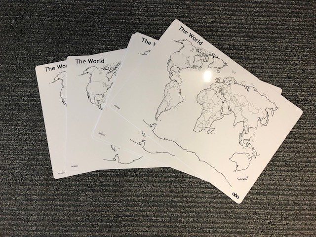
These giant whiteboards have been imprinted with outlines of the British Isles and the Continents/Countries of the world. Designed to be interacted with by children for a wide range of purposes and reused over and over again.
Find this resource: CR 912 WOR (EQ)
Continents and Countries Map
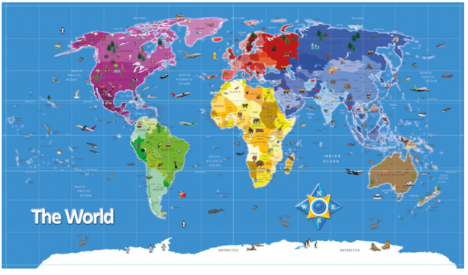
This large, vinyl map of the world is a great resource for the classroom. Large visual representation for the continents, distinguished by colour. Countries are then identified by different shades of the continent colour.
- North America – Purples
- South America – Greens
- Africa – Yellows
- Europe – Reds
- Asia – Blues
- Australia – Browns
- Antartica – Whites
Find this resource: CR 912 MAP (EQ)
Biomes World Map
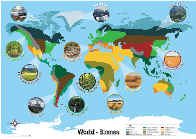
A large map poster of the world depicting global continents. Various biomes of the world are then identified across the continents including: Tundra, Grassland, Mountains, Rainforest, Savannah, Desert, Temperate forest and Taiga Forest.
The National Geographic is a great resource for all this natural world. Check out the different types of biomes article and maybe follow several of the links for additional biome information.
Find this resource: CR 912 BIO (EQ)
Globe: Inflatable
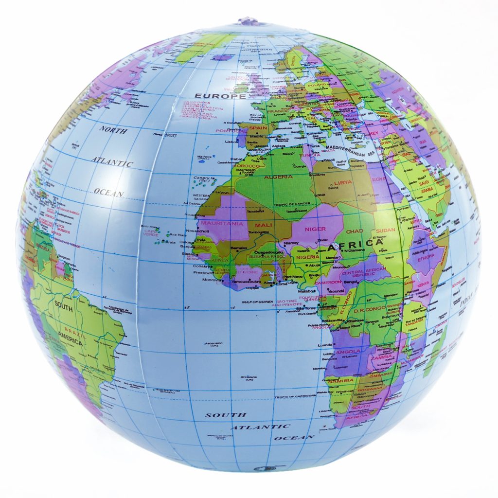
A huge inflatable globe depicting continents, countries, cities and rivers of the world.
This pack includes a pump for hygienic purposes.
Find this resource: CR 912 GLO (EQ)
Map symbols flashcards
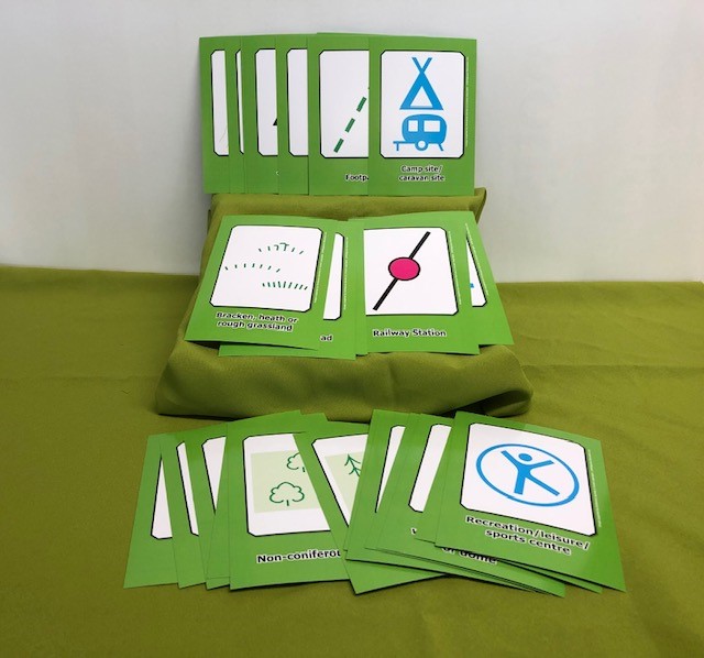
Both packs contain 32 reversible, hard wearing cards covering a range of symbols that can be found on every day maps. One side solely shows a large representation of a map symbol while the reverse includes a descriptive title along side the map symbol.
Classroom ideas
- Map symbol recognition bingo
- understanding maps
Find this resource: CR 912 MAP (EQ)
Compass: Bee-Bot 10pk
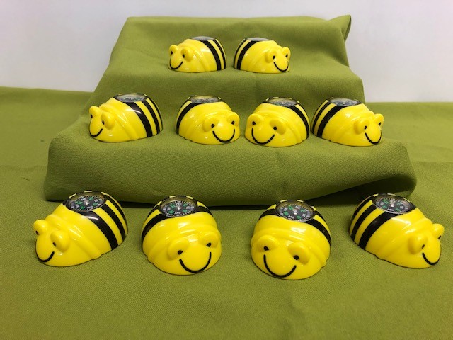
This pack includes ten, small, child friendly compasses, each with very clear directional information. These are all imbedded within plastic holders representing bright, colourful bumble bees. Great for young children.
Can easily be used to develop understanding for compasses, the cardinal directions, and putting this information together to form personal directional information, whether it is inside or out.
Classroom ideas
- Exploring a compass and how they work
- Plotting directions on a map
There is plenty of help out there when getting to grips with compasses, the names of all there parts, and how best to use them, for example gear junkie.
Find this resource: CR 912.014 COM (EQ)
Books – Non-Fiction
Teaching atlas – making sense of the world – lower primary
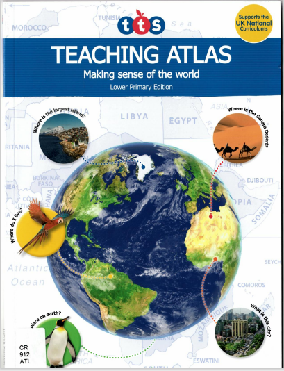
Written by TTS
Designed to help with and build knowledge on all areas of the geography curriculum
Find this book: CR 912 ATL
Teaching Atlas – Making sense of the world – upper primary
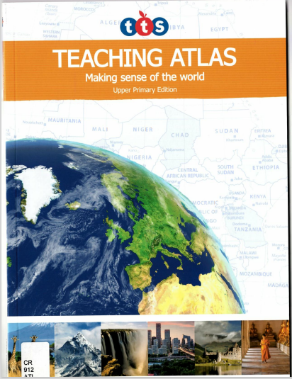
Written by TTS
Designed to help with and build knowledge on all areas of the geography curriculum
Find this book: CR 912 ATL
Powerful primary Geography – A toolkit for 21st century learning
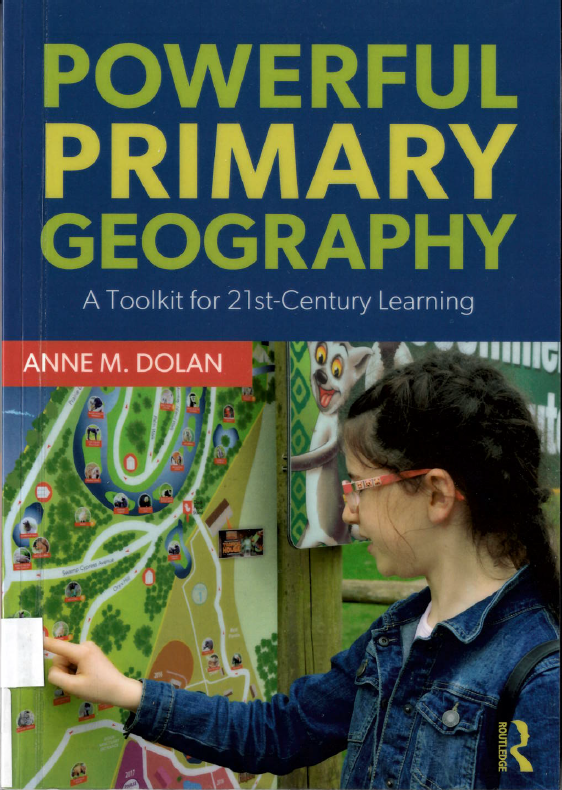
Written by Anne M. Dolan
A look at how we can teach geography today, in a fun, playful manner.
Find this book: 910.713 DOL
Mastering primary geography
Written by Anthony Barlow & Sarah Whitehouse
Explore new ideas on how to peak students curiosity with geography and develop life long skills.
Find this book: 910.713 BAR
Collins junior Atlas – learn with maps
Explore beautiful, colourful maps looking at countries, locations and graphical data.
Find this book: CR 912 COL
Collins school Atlas – Learn with maps
Explore updated in-depth maps, satellite imagery and global information.
Find this book: CR 912 COL


